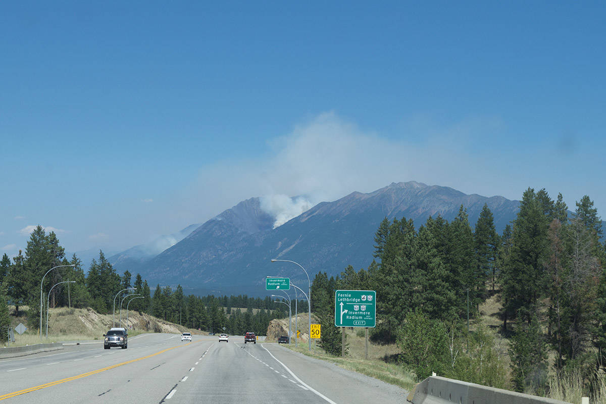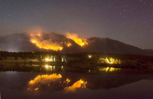
As of Monday, July 19, at noon, the Bill Nye Mountain wildfire, located southeast of Wasa, has grown to nearly 900 hectares. The Bill Nye fire is listed as a fire of note, and was discovered over a week ago.
The BC Wildfire service has a helicopter bucketing Monday and assisting with flying officers to monitor fire growth. Five firefighters and two pieces of heavy equipment continue to focus on building guard, says a statement from the Regional District of East Kootenay.
“They are reporting good progress on both the machine guard and hand-built fuel free break at the base of the hill,” said the statement. “Fire behaviour continues to be a low to moderate surface fire, with flare-ups as pockets of previously unburned fuels are found. The majority of fire growth is happening upslope into higher elevations.”
Bill Nye is listed at 873 hectares as of Monday.
The evacuation alert remains in effect for the Lazy Lake, Lakit Lake and Holmes Road area, as well as one property on the Wildhorse Forest Service Road. As of press time, this is the only evacuation alert in effect for the East Kootenay.
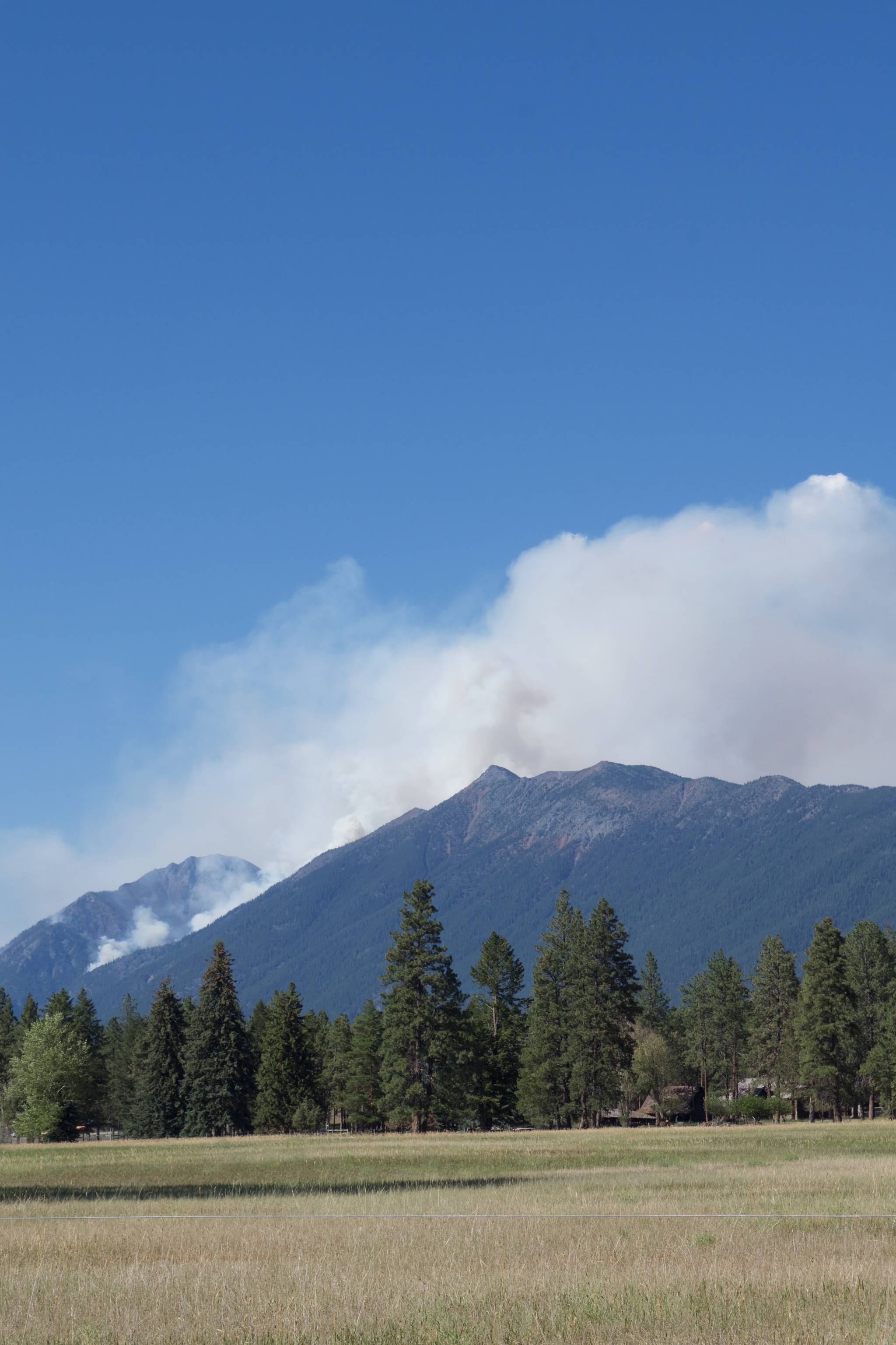
The Tanglefoot Creek fire is listed at 195 hectares as of Monday and is listed as out of control. Smoke from this fire is visible above Fisher Peak.
The Big Lake Fire, southeast of Wasa, is listed at 11 hectares and being held.
The Ptarmigan Fire (in the Whiteswan area) is listed as out of control at 18 hectares.
Information on all fires in the area can be found on the BC Wildfire Service dashboard and phone app.
Environment Canada is also warning of potential thunderstorms and strong winds, starting Monday afternoon.
“If the isolated convective thunderstorm cells develop, there could be intense rain/hail, lightning and strong winds in the immediate area of the storm,” said the RDEK.
READ MORE: Smoke seen rising from behind Kimberley ski hill most likely from Akokli Creek fire
READ MORE: Area restriction in effect for Akokli, Redding Creek areas
Area Restrictions
The BC Wildfire Service has also implemented several area restrictions over the past several days. They are listed below:
An Area Restriction is in effect around the Tanglefoot Fire (30km NE of Cranbrook):
o From the junction of the Galbraith FSR & Tanglefoot Creek FSR, north following the Galbraith Creek FSR, then north and east to the height of land to Duncan Creek, then west along the height of land to Mt Smith.
o Then following the height of land to the south through Mt Fisher, back to east until the junction of the Bull Van FSR and Bull River Main FSR, then north to the commencement point.
o Note: travel along the Bull River Main FSR, Bull Van FSR and Galbraith FSR is permitted.
An Area Restriction has also been put in place around the Ptarmigan Creek Fire (in the Whiteswan area):
o From the junction of Moscow FSR & the NE corner of Whiteswan Provincial Park, west along Whiteswan Provincial Park northern boundary, then north up to White Knight Peak, north along the height of land to Edwards Peak, east along Edwards FSR to the commencement point at Moscow FSR.
o Note: access to Whiteswan Provincial Park and travel on the Moscow FSR is permitted. Travel along Edwards FSR is prohibited.
There are also area restrictions for the Akokli Creek, Redding Creek and Dewar Creek areas as well.
Be Prepared
Municipal and provincial government officials have urged residents across BC to be prepared in case of a fire-related emergency or evacuation. Building a household emergency kit and grab and go kit are two things you can do now to be prepared.
An emergency kit should include things such as non perishable food, water, phone charger and battery bank, radio, flashlight, extra batteries, personal toiletry items, cash in small bills, copies of important documents (such as insurance papers), extra clothing and footwear, emergency blankets, etc.
A grab-and-go bag should be ready in case you need to leave immediately. This should include ready to eat food and water, phone charger, radio, flashlight, batteries, small first-aid kit and personal medications, toiletries, emergency plan, important documents, cash in small bills, map with family meeting place, pen and notepad, and items such as extra pet food.
corey.bullock@cranbrooktownsman.com
Like us on Facebook and follow us on Twitter
Want to support local journalism during the pandemic? Make a donation here.