Avalanche danger continues to improve heading into this week, after last week’s storm across the interior created a large natural avalanche cycle, but a weak layer buried deep in the snow still poses some concern to forecasters.
Avalanche Canada forecaster Julie Leblanc said that the region received 30 to 45 centimetres of wet snow, and freezing levels were almost all the way to the mountain top, which created the natural avalanche cycle in various valleys.
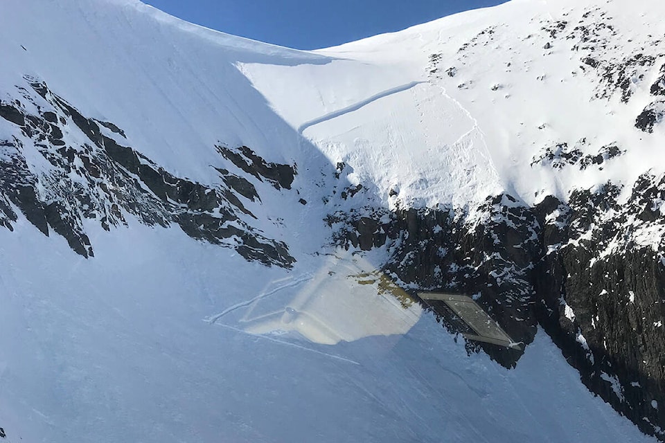
“We have seen a lot of giant avalanches, size three that could bury a car, all the way to valley bottom,” Leblanc said. “So we’ve seen cornice falls, wet slabs running and reaching valley bottoms and these avalanches occurred yes within the storm snow, because there is a fair amount of snow, but they also stepped down to a buried weak layer.”
That buried weak layer was buried back in early December and is now over a metre beneath the snow, and is part of the reason the area has seen large avalanches recently.
As the snowpack warmed after the cold stretch over the Christmas holidays, that caused numerous avalanches in drainages and slopes, and all the way to the mountain tops.
Then a stretch of very warm days and sunshine was enough to again trigger large avalanches.
“That was the first time that new snow saw the sun for the first time, very large up to size three, around the Whitewater area and down around the Fernie area as well and up in the Valhalla mountains,” Leblanc said. “They occurred right in the storm and a few days after so Wednesday, Thursday, mid last week.”
Avalanche Canada was expecting last week’s storm to trigger that deeply-buried persistent slab and it did, resulting in avalanches much larger than could be expected, running at size 3 all the way to valley bottoms.
Conditions are now improving, with freezing levels going down and temperatures cooling back off, which tends to see danger ratings drop as well. Most mountain ranges are sitting in the low to moderate ranges all the way up the mountain.
That December 1 weak layer, however, is still a pit of a problem for forecasters. It is buried from one to two metres deep and is difficult to forecast, Leblanc said, and it has shown some activity during and after the storm.
The likelihood of triggering it isn’t necessarily high, but if one were to find a shallow area and trigger it, it could trigger something very large.
The weak layer is due to the early-winter atmospheric river and big rain event.
“Our recommendation is if you still see it in the public bulletin, keep a wide margin of safety as you go into the backcountry, because it’s still a concern, it’s not going anywhere,” Leblanc said. “It’s still there and it’s high consequence. So that’s why the danger rating is still moderate, moderate, low, for the next few days, for the mid week anyway.”
Be sure to check www.avalanche.ca for up to date avalanche forecasts if you’re planning to head out into the backcountry.
paul.rodgers@kimberleybulletin
Like us on Facebook and follow us on Twitter