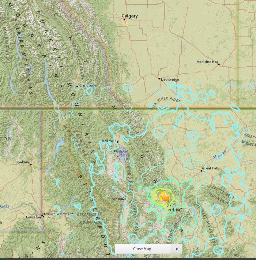
Kimberley and Cranbrook residents who were awake in the early hours of July 6, 2017 felt the tremors as an earthquake occurred nine kilometres southeast of Lincoln, Montana at 12:51 mountain time. Some residents reported feeling their beds shake.
According to US Geological Service website, the July 6, 2017 M 5.8 earthquake southeast of Lincoln in western Montana occurred as the result of shallow strike slip faulting along either a right-lateral, near vertical fault trending east-southeast, or on a left-lateral vertical fault striking north-northeast. The location and focal mechanism solution of this earthquake are consistent with right-lateral faulting in association with faults of the Lewis and Clark line, a prominent zone of strike-slip, dip slip and oblique slip faulting trending east-southeast from northern Idaho to east of Helena, Montana, southeast of this earthquake. The Lewis and Clark line is a broad zone of faulting about 400 km in length, and up to 80 km wide (wider to the east). Faults within this zone, primarily of Middle Proterozoic to Holocene in age, can be traced as much as 250 km along strike, and typically change in strike from east (near Idaho) to southeast (near Helena). In the region of the July 6th earthquake, prominent faults include the St Mary’s-Helena Valley fault, and the Bald Butte fault, both right-lateral structures. More detailed field studies will be required to identify the causative fault responsible for this earthquake.
Western Montana and northwestern Wyoming have experienced at least 16 other M 5+ earthquakes within 300 km of the July 6, 2017 event over the preceding century, according to the USGS. The largest was the August 1959 M 7.2 Hebgen Lake earthquake – the largest historic event in the intermountain region – which occurred about 280 km to the south-southeast of the July 6th event. The Hebgen Lake earthquake triggered a large landslide that resulted in significant damage and more than 28 fatalities. A M 6.9 earthquake just over 100 km to the southeast of the July 6th earthquake in June, 1925, caused significant damage, but no fatalities. A M 5.6 earthquake occurred 170 km to the south of the July 6th event in July 2005, and caused minor damage in the surrounding region.
Residents across southern B.C. all the way to Vancouver reported feeling the tremors.
Lincoln, Montana is about a five hour drive southeast of Kimberley, a distance of 476 km.