Homes have been evacuated along Fairmont Creek, while other properties in the area remain on an evacuation alert following localized flooding on Sunday due to heavy weekend rainstorms.
The Regional District of East Kootenay issued a State of Local Emergency on Sunday, evacuating residents at 24 properties along Fairmont Creek south of Marble Canyon on Sunday afternoon.
An evacuation alert was later issued for 33 properties in the Cold Spring Creek area of Fairmont due to the potential for debris flow.
READ: Homes evacuated in Fairmont due to localized flooding from heavy rainfall
A reception centre for evacuees has been set up at the Kanata Inn in Windermere.
RDEK staff are on site and monitoring the creeks, while also working with the Fairmont Hot Springs Resort to ensure culverts remain unblocked by debris.
On Sunday evening, the RDEK also issued a water boil advisory for the Edgewater water system due to high turbidity levels from the rainfall adn recent runoff.
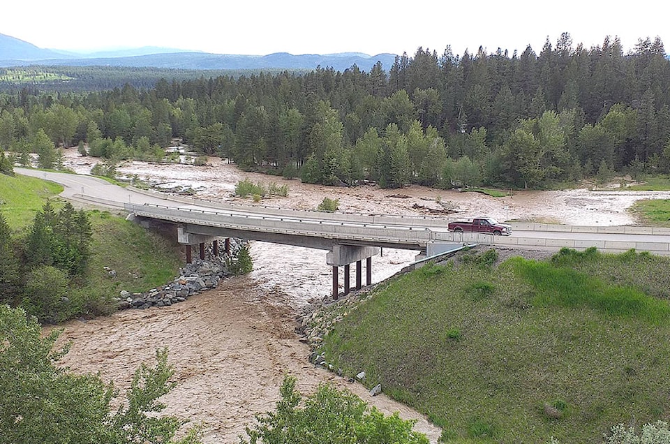
Localized flooding also shut down Highway 95 south of Spillimacheen for a 3.2 kilometre stretch on Monday morning, according to Drive BC.
#BCHwy95 near #Spillimacheen still CLOSED due to flooding. pic.twitter.com/asvmSawR0J
— Rocky Mountain District (@TranBCRockyMtn) June 1, 2020
Regionally, high stream flows is also causing flooding across other parts of the East Kootenay.
The B.C. River Forecast Centre upgraded Moyie River and the surrounding tributaries to a flood watch on Sunday, while other local waterways have been steadily rising.
The Wildhorse Creek near Fort Steele has flooded over the banks, forcing nearby campers to evacuate, while regional Forest Service Roads have been hit hard.
The Bull River Rd has been completely washed out four kilometres up from the Fort Steele-Wardner Rd, while the White Swan Forest Service Road has also been washed out from Mutton Creek, making Whiteswan Lake Provincial Park inaccessible by vehicle.
Bull River near Wardner peaked on Sunday and the water levels are now receding, according to the BC River Forecast Centre, while the Kootenay River at Fort Steele continues to rise.
A thunderstorm rolled through the BC Interior over the weekend, bringing up to 10-50 millimetres of rain. Evacuation Orders have been issued in the West Kootenay by the Regional District of Central Kootenay for properties in the Ymir, Salmo and Duhmael Creek areas.
trevor.crawley@cranbrooktownsman.com
Like us on Facebook and follow us on Twitter
Want to support local journalism during the pandemic? Make a donation here.